And now for a non-bookie post. Quite clearly it’s been awhile, but this seemed the right place to make a note.
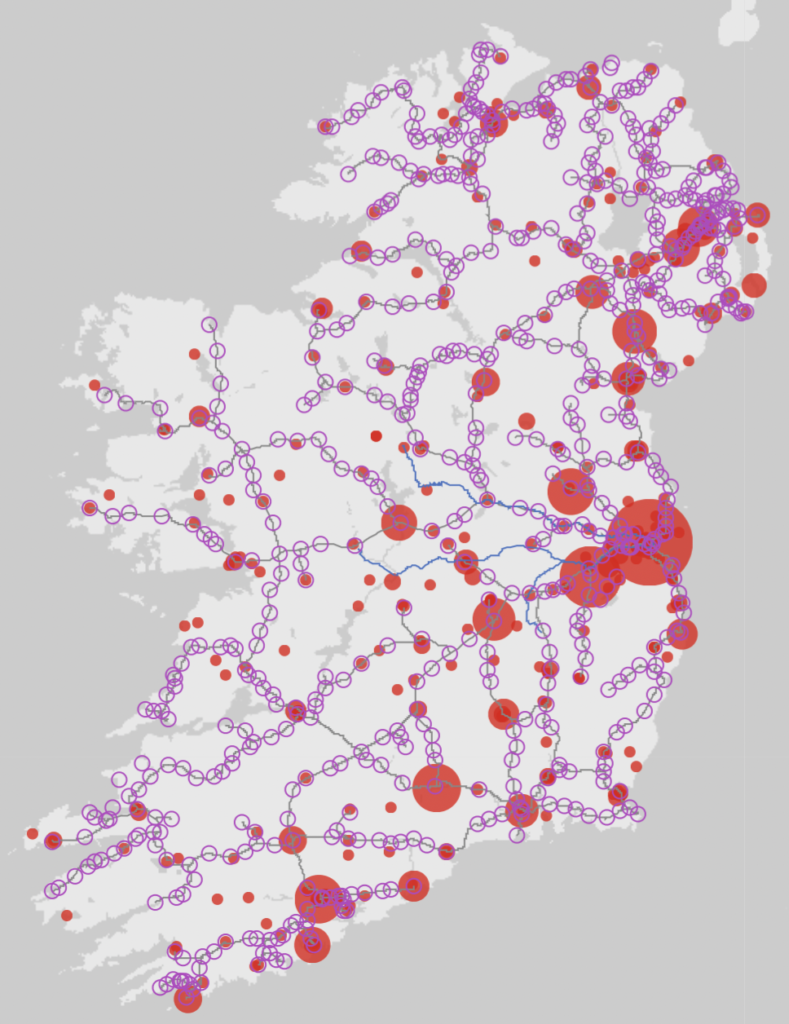
Wanting to make very quick look at now the changing spatial distribution of Irish breweries over the past 300 years might be related to the availability of transport infrastructure I wanted to overlay my maps of historical breweries with the availability of historical railways and canals. Although it’s possible to find png and other raster imagery that offers indicative railway paths, I could not locate a handy downloadable vector (or better yet geo spatial data) file of railways or canals. Although you can find some nice browsable databases, the data was not downloadable – although there were offers of being able to purchase a file in the future. Not my thing. I hate to have to waste the time compiling – especially as I really didn’t need much precision – but in the future I’d rather a researcher had malleable data at their fingertips.
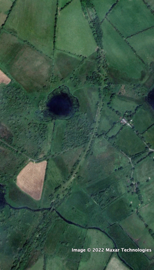
So…using some rudimentary data extracted from OSM via overpassTurbo and then doing some hard target imagery observation I mapped – as best I might – the vanished railbeds – and attempted to cross-reference them with textual references and the occasional archival railway track plan. As it turned out this was not and easy – nor quick – task, but the forensics are wonderfully (and distractingly) engaging. As you can see from the shot to the left, there is pretty substantial visual evidence from this satellite imagery that something man-made – and quite possibly a railbed ran here (for the record it’s just north of Castleblaney and is a spur of the Great Northern running from Castleblaney to Armagh). I have mapped the lines, the stations based on similar visual and archival evidence and created geoJSON files for my use – and downloadable for your own if you can use them.
I will note that I will be modifying them as I go as they are about 90% there. They are more detail than I need but not quite the optimal precision that I could generate. As well, the timespan data (when opened and if applicable when closed) doesn’t seem to have exported from my source file. I will be adding.
I had also started to add to OpenStreetMap as this is where I would expect to share it, but after discussion with a couple other mappers – it is not really a repository source for these sort of historical references. I did place a variety of abandoned stations on the map (and to my shame) and also connected some of the visual remnants that others had contributed but I stopped following discussion. Nonetheless I did want to find a platform to share this data in hope that others might find useful and to save them the bother I faced, so to GitHub.
There are three files thus far:
They are free for use. Nice if you find useful and happen to attribute but no demands made.
There’s lots of data there!