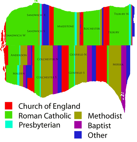
This map is an experimental presentation of manuscript census declaration of religious affiliation in the townships of Essex County Ontario in 1851. It s bit of an experiment to see how stacked bars look when they are conformed to the township boundaries. It kind of works…just a random thought.

